

Hiking and off-roading at the Needles in Canyonlands
Canyonlands National Park spreads across 337,598 acres in southeastern Utah, divided into 3 districts by the Green and Colorado rivers: Island in the Sky, the Needles, and the Maze. In early May, after exploring popular Island in the Sky, we drove to the Needles on another day to see its purple sandstone spires and American Indian pictographs and give off-roading a try.
The Needles is a quieter part of Canyonlands, less visited and with less elevation. But the views are still fabulous.
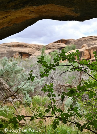
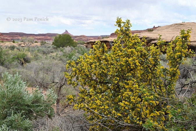
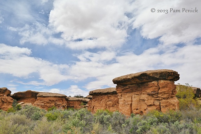
After the visitor center, we headed to Cave Spring Trail. The scenery — lavender buttes, terracotta rock, and green desert plants in spring bloom — was marvelous.
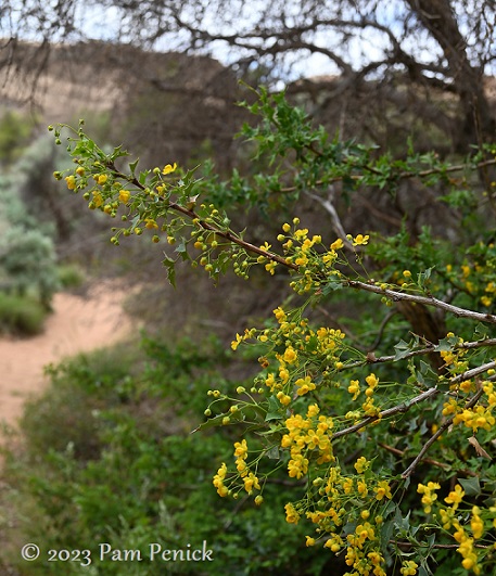
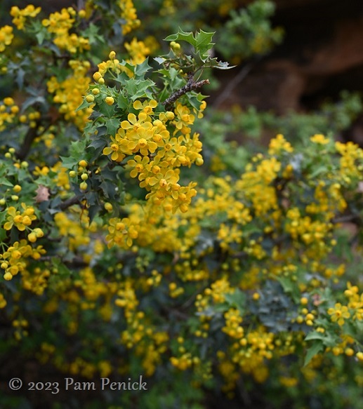
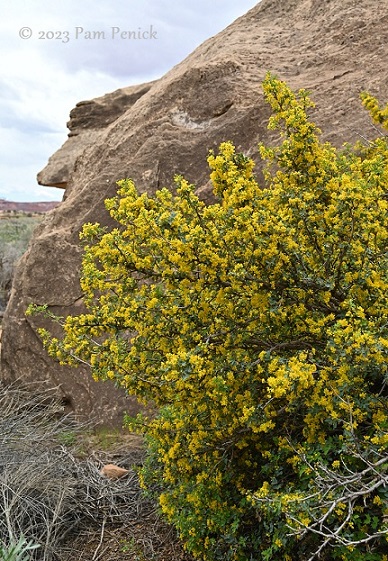
Fremont mahonia (Mahonia fremontii) was flowering butter-yellow along rock walls.
Beautiful and a tough desert plant
Pictographs
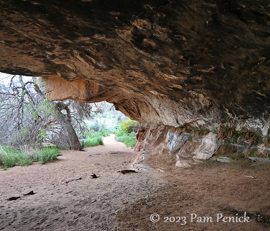
Cave Spring Trail leads past an old cowboy camp under a cliff overhang; you can see a photo on the NPS website. The camp contains a few rustic tables, cans, and tools. Cattle ranching inside the park ended in 1975. But long before the cowboys of the late 20th and early 21st century, nomadic native people occupied Canyonlands. For around 6,000 years, American Indians followed herds of bison and other animals, leaving their marks on the rock walls.
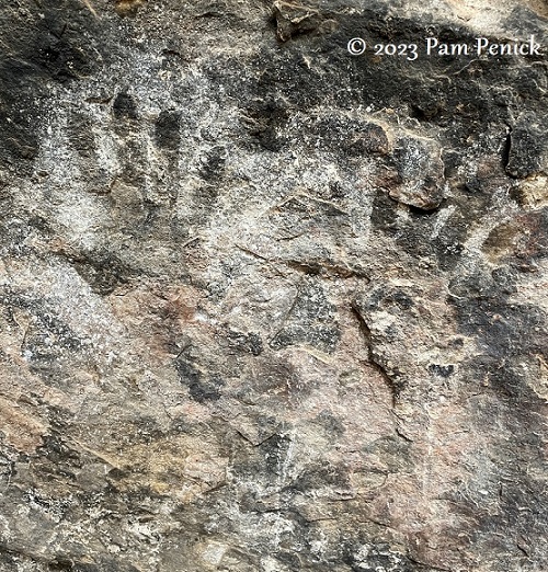
The ghostly evidence of their lives survives today in the form of pictographs. Powdered minerals were used to make pigments that ancient artists blew across hands pressed to cave walls, creating a negative image.
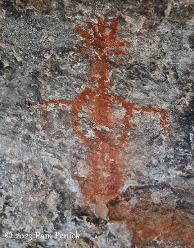
Humanoid figures and animals are represented too.
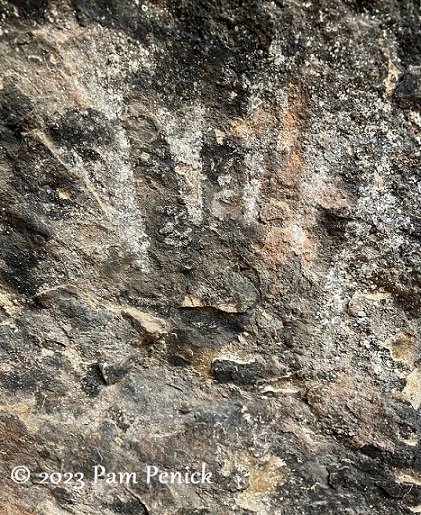
A hand pictograph is a signature. I was here.
A spring trickling at the base of the rocks attracted Indians and cowboys and allows plants to flourish.
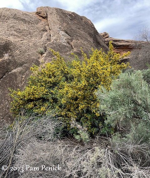
Fremont mahonia
Beautiful!
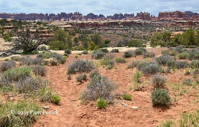
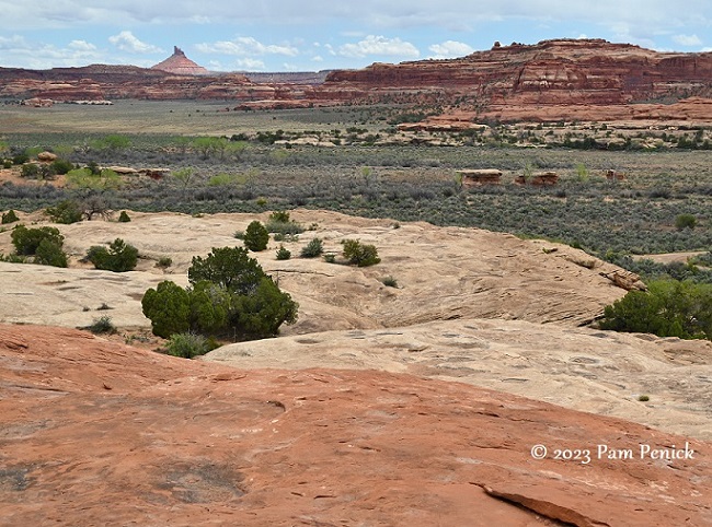
Cave Spring Trail
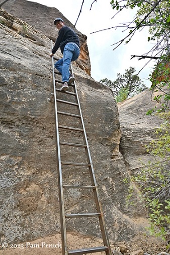
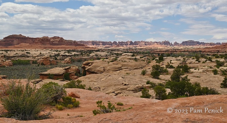
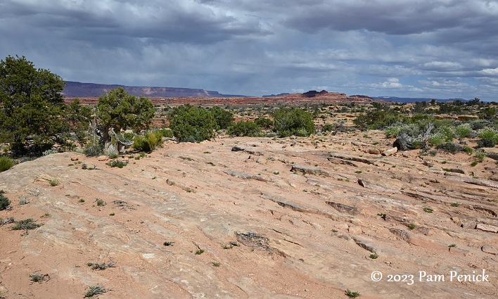
After winding among the rocks, the trail leads to a ladder. Climbing up you reach an undulating expanse of slickrock, i.e., bare rock.
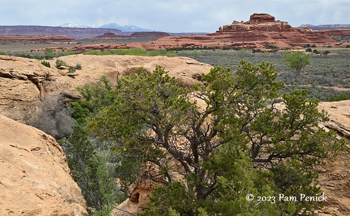
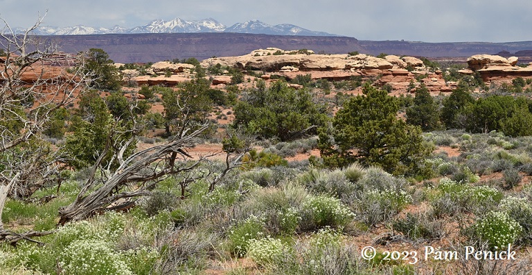
From this vantage point, you enjoy wide views of surrounding buttes and snow-capped peaks in the distance.
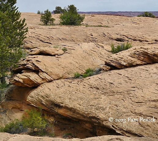
Interesting rock texture
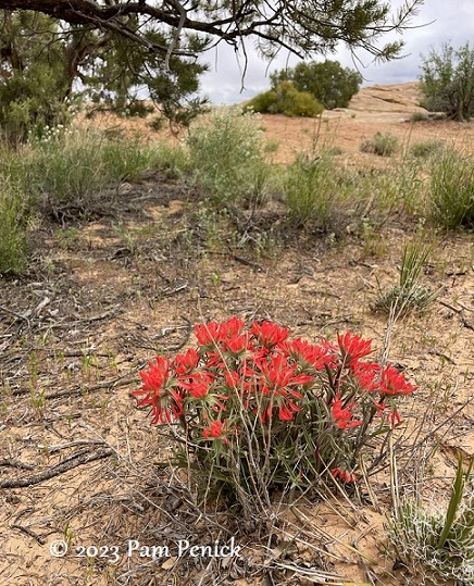
Wildflowers were blooming here and there in early May.
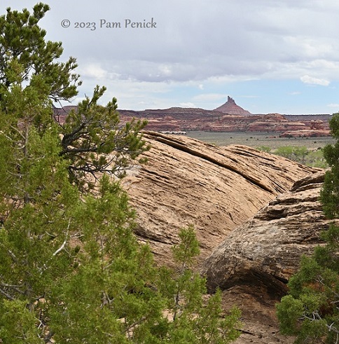
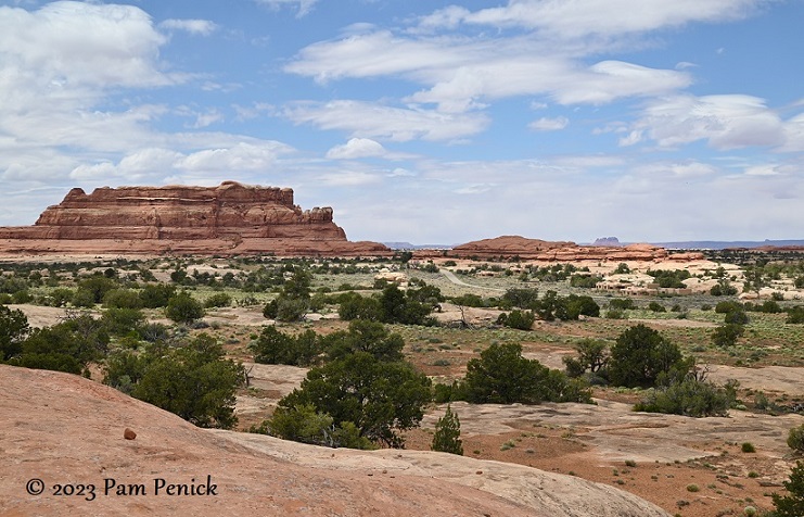
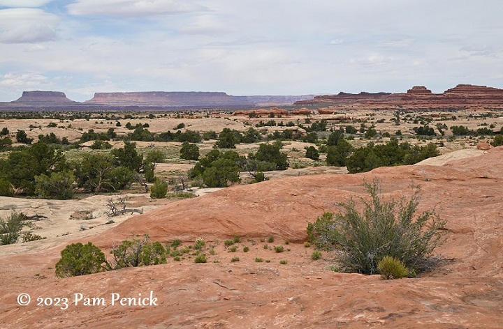
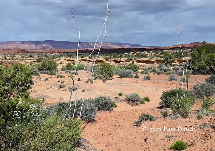
The Needles
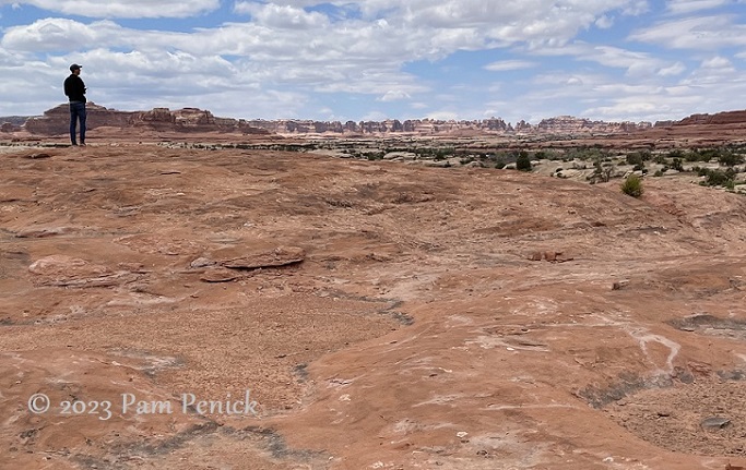
The Needles, an iguana’s back of purple sandstone, notch the distant horizon.
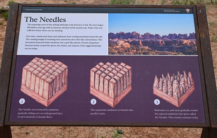
A sign explains how the Needles formed:
“The surprising secret of this striking landscape is the presence of salt. The story begins 300 million years ago with an immense salt layer left by ancient seas. Today it lies over 1,000 feet below where you are standing. Over time, coastal sand dunes and sediments from eroding mountains buried the salt. The crushing weight of overlying rock caused the salt to flow like cold molasses. This movement fractured brittle sandstone into a grid-like pattern. Erosion along these fractures slowly created the spires, fins, buttes, and canyons of the rugged landscape you see today.”
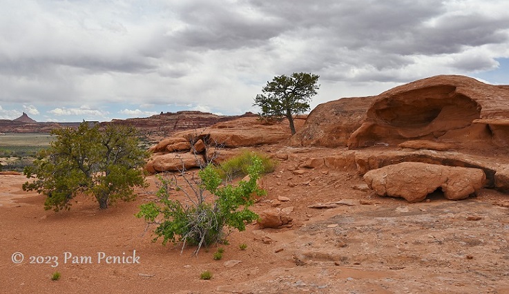
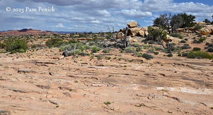
Following cairn trail-markers, we explored the elevated slickrock.
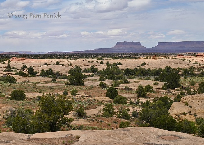
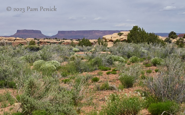
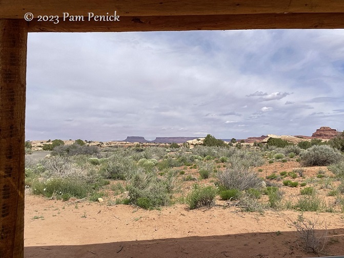
Colorful buttes punctuate the sky all around.
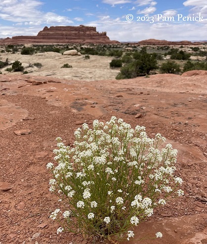
An unknown-to-me wildflower
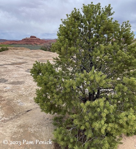
Even trees find a way, slowly splitting rock in the process.
A Martian landscape
The loop trail eventually leads down from the slickrock. I enjoyed seeing these mushroom formations near the parking lot.
Off-roading
The Needles offers “50 miles of challenging backcountry roads [that] lead to campsites, trailheads, and many natural and cultural features. All of these roads require high-clearance, low range four-wheel-drive vehicles. Inexperienced drivers should not attempt these roads. There is a high risk of vehicle damage, and towing costs usually exceed $1,500.”
My husband read all that and said, “Let’s do it.” Were we experienced off-road drivers? Nope. But he’d purchased a used F-150 pickup to pull our rented RV for the 5-week, 8,600-mile trip, and by gosh we were going to get the full use of it.
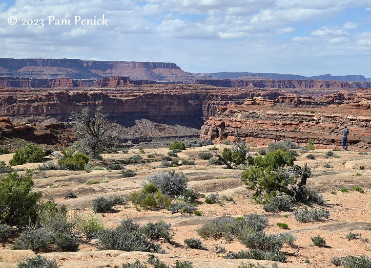
After consulting with a laid-back ranger, we decided that the Colorado River Overlook “road” would be the best bet for newbies like us. I drove because…why not? And it was pretty fun at first! We jounced over the sandy, rutted dirt road for a while, and then it turned to layered strips of sandstone, boulders, and stair-like drops that you had to slooooooowly ease through.
This is the road — an easy stretch!
That boulder on the right looks like a skull.
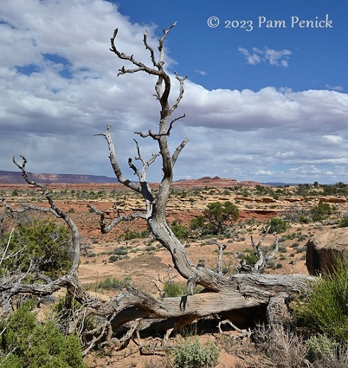
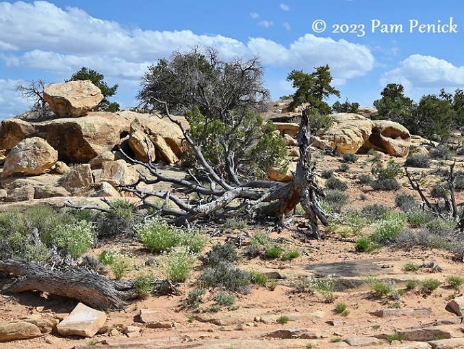
Sculptural tree carcass
Finally the road became too challenging to continue, at least for us. We could easily imagine gutting the underside of our truck or getting hung up on a ledge of rock.
“You can avoid the large rocks and stair-step drops in the last 1.5 miles by parking on the road and walking to the overlook,” NPS says. We weren’t really prepared for a mile-and-a-half desert trek down a giant’s-stair sort of road. We contented ourselves with peeking over the edge of the canyon, sans river views. It was still good. We made a million-point turn and got the truck turned around and headed back, with me riding shotgun this time so D. could have a turn behind the wheel.
The Needles offered a different Canyonlands experience and another fun adventure, plus plenty of colorful scenery.
Up next: Messages from the past at Newspaper Rock, one of the largest known collections of petroglyphs. For a look back at the majestic views of Islands in the Sky and Shafer Trail road in Canyonlands, click here.
__________________________
Digging Deeper
Come learn about gardening and design at Garden Spark! I organize in-person talks by inspiring designers, landscape architects, authors, and gardeners a few times a year in Austin. These are limited-attendance events that sell out quickly, so join the Garden Spark email list to be notified in advance; simply click this link and ask to be added. Season 8 kicks off in fall 2024. Stay tuned for more info!
All material © 2025 by Pam Penick for Digging. Unauthorized reproduction prohibited.
I just LOVE your blog – most of your photos (especially the vistas) are downright frame-worthy. If I had a windowless office, like many people do, I would frame these and line the walls with them for a 360 degree view. Good job!
Paula, thank you so much for the lovely compliment! It makes me happy to know you enjoy my photos. 🙂
Great article, great photos! I’m so glad you included the information about how the needles were formed–I know very little about geology, and what I do know came from NPS signs!
I’m not sure I could have talked myself into climbing that ladder! But the payoff was undoubtedly worth it.
It definitely was, Debra. I’m glad the ladder has been upgraded to steel or aluminum. It used to be a ladder of wooden poles!