

Canyonlands: Purple canyons and cliff-clinging Shafer Trail
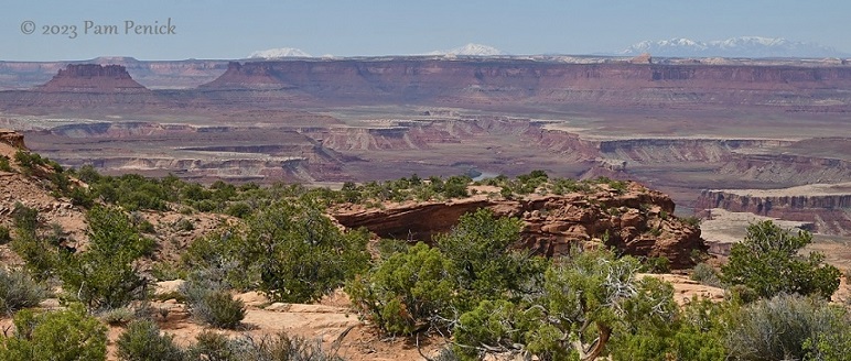
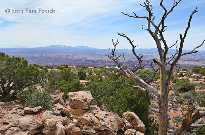
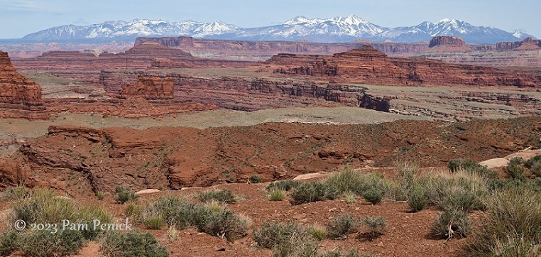
Terracotta sand and rock stubbled with green. Terraced buttes of mauve and lavender. Blue mountains with snowy, sawtoothed peaks. A vast sky and stomach-dropping abyss. Canyonlands National Park in southeastern Utah offers awe-inspiring western vistas, beauty, and adventure and was my favorite among the Utah parks we visited on our spring RV trip.
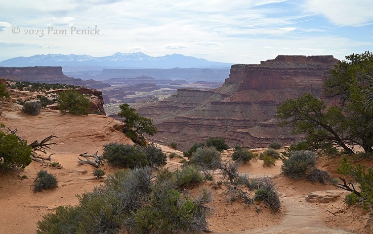
Island in the Sky
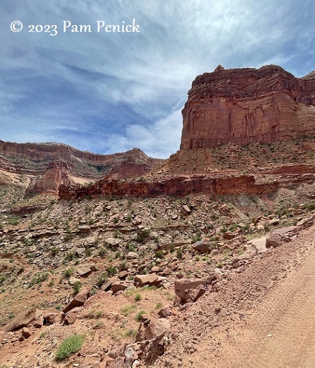
We took two days to see Canyonlands. On the first day, pictured in this post, we explored the park’s Island in the Sky district, stopping at overlooks and making a thrilling plunge into a canyon via Shafer Trail drive.
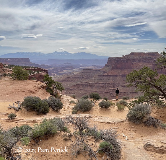
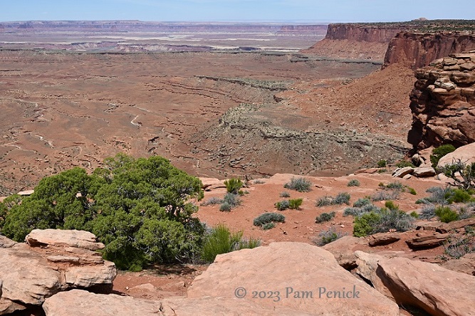
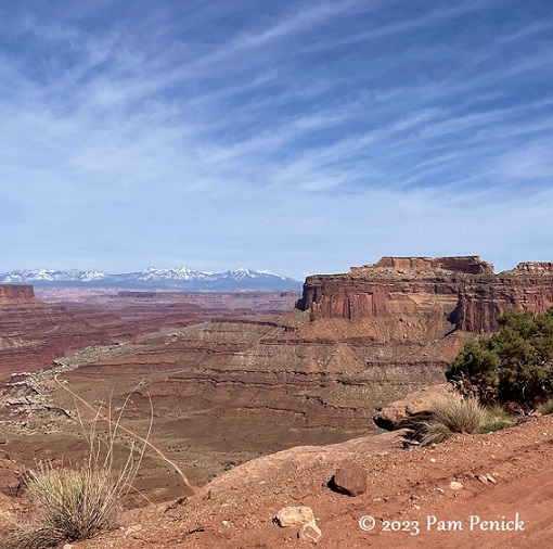
The views are epic at Canyonlands.
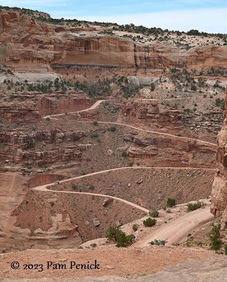
And a little terrifying. From the visitor center overlook, we gazed across the gulf to a red dirt road clinging to a skinny ledge 1,500 feet high. No guardrails. Was this a hiking trail? No, it’s a road. For vehicles. For people to drive actual vehicles on. My husband turned to me and said, “Let’s do it.”
“No way,” I replied. “Nope. Uh-uh.” I repeated that nope all morning and through our picnic lunch before relenting because…we were there. And the road was there. And every day do something that scares you, right?
But first we spent the morning driving the main road, stopping at overlooks, and hiking short trails to admire the incredible scenery.
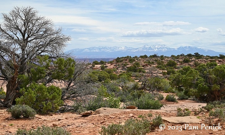
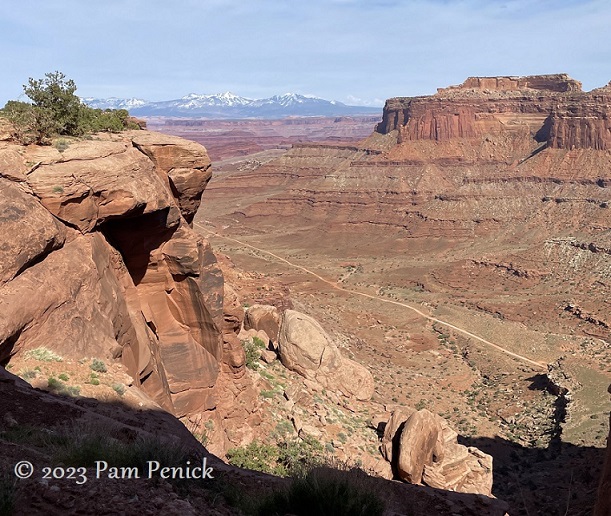
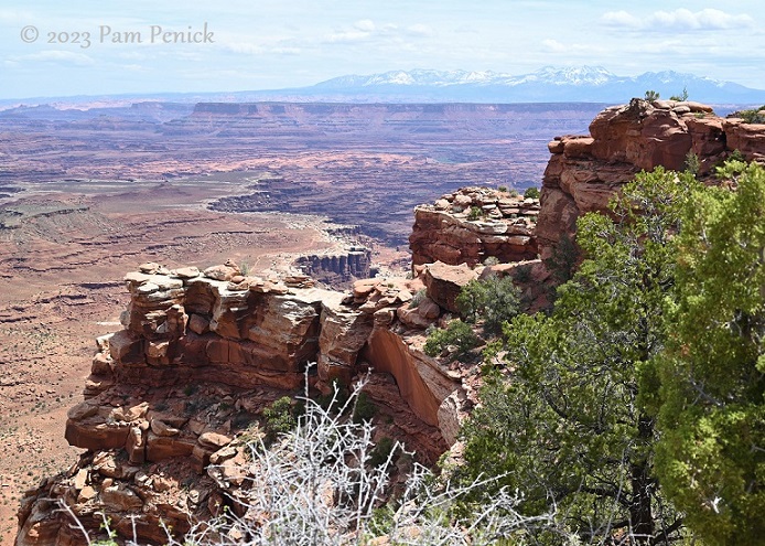
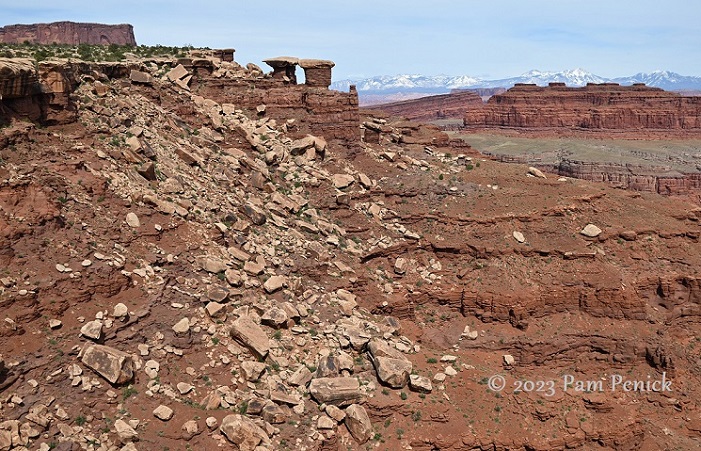
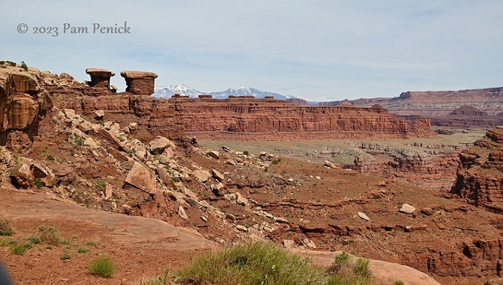
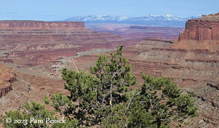
Seeing those snowy peaks in the distance, floating above the high-desert landscape, enhances your sense of Canyonlands’ vast scale.
Water created this unique desert landscape, ironically. Two rivers, the Colorado and the Green, are still carving deeply into canyons. In addition, summer rainstorms create erosive, temporary streams that course over mesas and buttes, sculpting soft sandstone into terraces, towers…
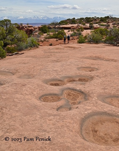
…potholes…
…and eventually, over millennia, this.
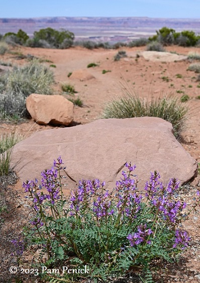
In early May, purple wildflowers were in bloom, color-coordinating with lavender canyons in the distance. I think this is milkvetch.
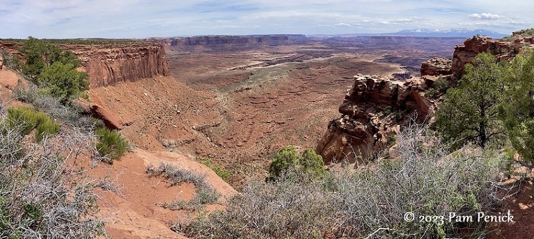
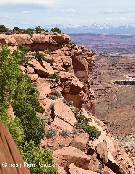
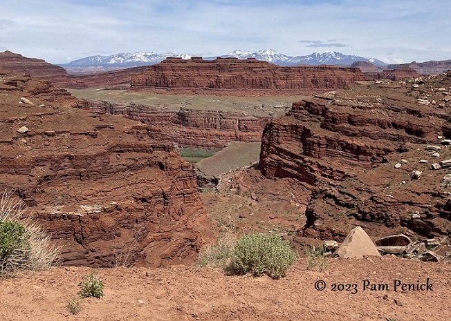
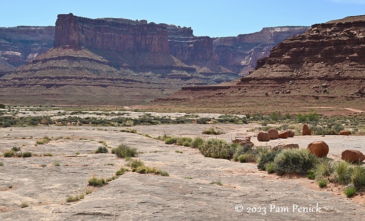
More canyon views
It’s hard to convey the scale of such vistas.
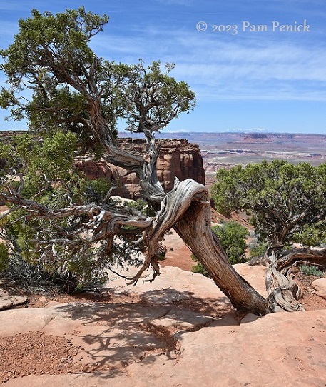
Even in a desert, a few trees manage to cling to rock, weathered into bent and picturesque form.
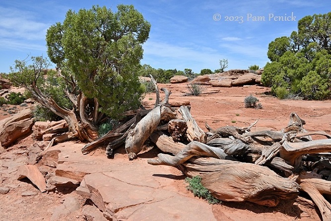
The twisted trunks of old broken trees are piled, at one overlook, into a boundary-defining fence.
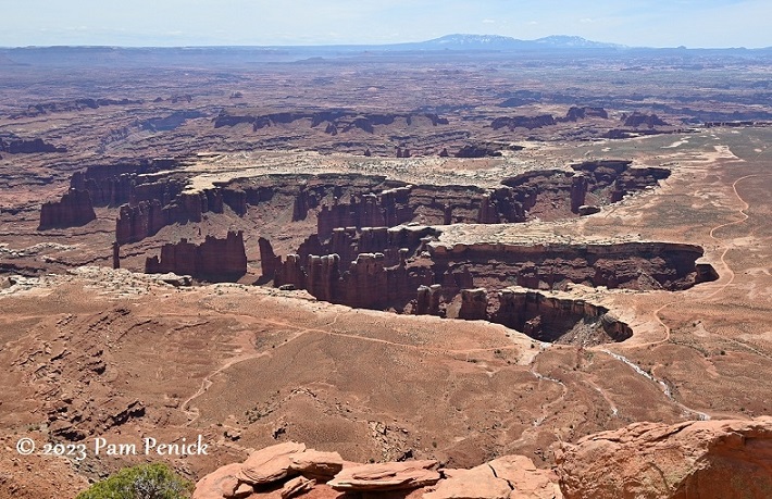
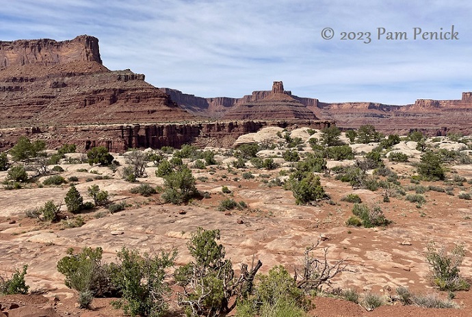
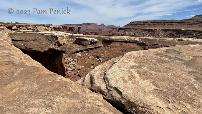
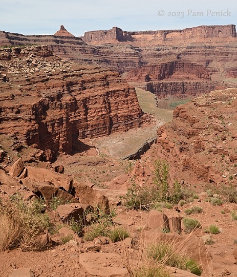
Canyons within canyons
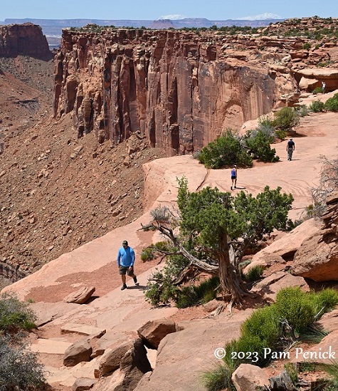
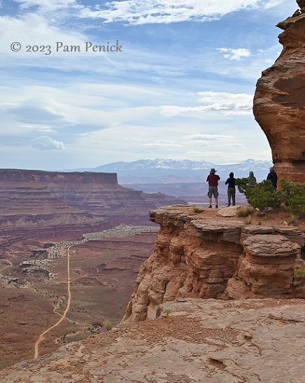
Hikers on a cliff-edge trail
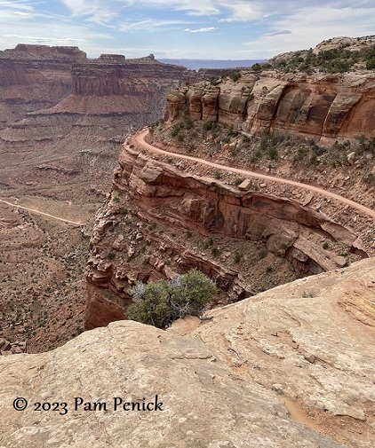
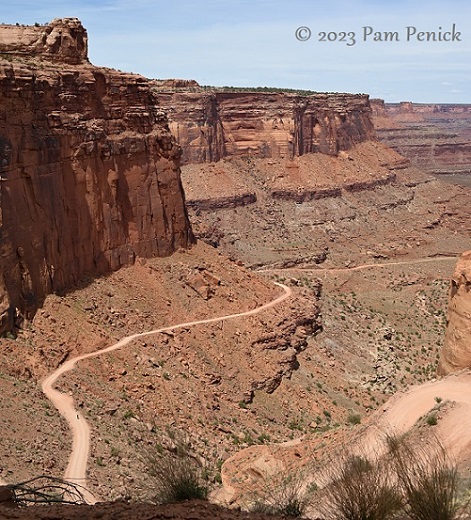
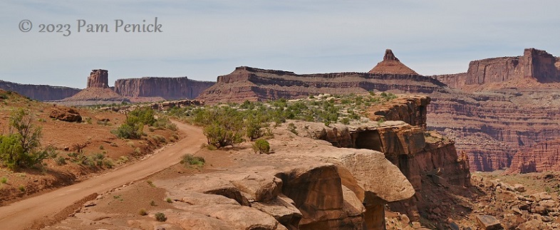
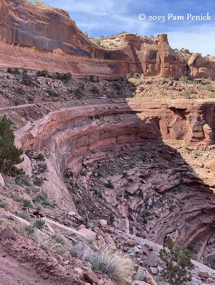
Shafer Trail
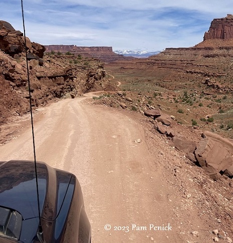
By midafternoon we’d looped back to the visitor center and the access point for Shafer Trail, the dirt road that clings to canyon walls as it snakes its way down 1,500 feet of guardrail-less exposure.
We were driving a big Ford F-150 pickup with 4-wheel drive, but we did see one or two “regular” cars on the narrow drive. And one bicyclist puffing his way up.
“The Shafer Trail…is an iconic road that descends 1,500 feet (457 m) through a colorful, massive sandstone cliff. Its function has changed through the years; from a route made by Native Americans to access resources on the mesa top, to a trail for sheep herders moving flocks to better foraging in winter time, and then a road for trucks moving loads of uranium from the backcountry to market. Today, the Shafer Trail is a challenging, unpaved backcountry road for recreational users seeking the experience of a lifetime.”
https://www.nps.gov/places/shafer-trail-viewpoint.htm
As we eased our way through the first several switchbacks on the descent, I sat tensely, taking few photos as I stole glances over the abyss a couple feet from the passenger window.
Canyon and river far below
But when we reached the inner canyon, I no longer felt we might fall off a crumbling cliff and could relax.
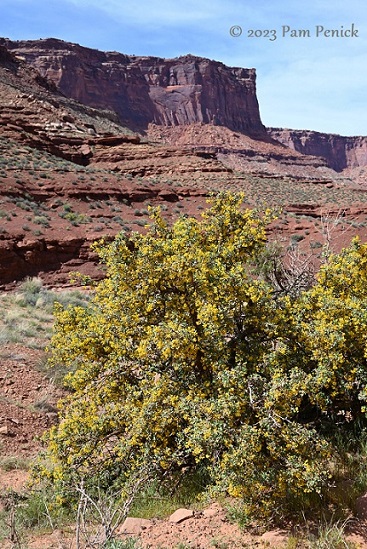
Fremont mahonia in buttery bloom
We saw a sign for Musselman Arch and walked out to see it. No, this is not the bottom of the canyon but a plateau.
Musselman Arch is technically not an arch but a natural bridge of stone. A skinny 6-foot width over a drop of 300 feet hasn’t stopped people from walking across this eroded slab. Some have even bicycled across it, I read. We simply marveled at it from a distance.
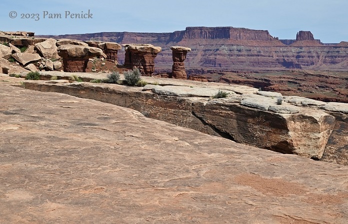
Toadstool-shaped pillars stand watch.
We didn’t go all the way to the canyon floor because the afternoon was growing late.
On the drive back up to the rim, I felt comfortable with the road and took lots of photos and video.
The scenery was right out of a Wile E. Coyote and Road Runner cartoon.
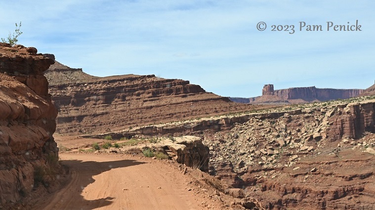
This shows how narrow the road is, and yes, it’s two-way. When another vehicle appears, you must squeeze to one side so you can pass.
Crumbled rock and still-standing hoodoos
A closer view
Here are 3 videos I took on the drive back up. Enjoy!
Part 1
Part 2
Part 3
Near the top, here comes another car.
What a drive! I’m glad I said yes. It remains one of the most memorable parts of our trip.
Canyonlands would beckon again another day, when we’d visit the Needles district, a 100-mile drive from Island in the Sky.
Up next: Hiking and off-roading in the Needles at Canyonlands. For a look back at Capitol Reef National Park’s petroglyphs, orchards, and pie, click here.
__________________________
Digging Deeper
Come learn about gardening and design at Garden Spark! I organize in-person talks by inspiring designers, landscape architects, authors, and gardeners a few times a year in Austin. These are limited-attendance events that sell out quickly, so join the Garden Spark email list to be notified in advance; simply click this link and ask to be added. Season 8 kicks off in fall 2024. Stay tuned for more info!
All material © 2025 by Pam Penick for Digging. Unauthorized reproduction prohibited.
I really enjoyed your fantastic photography of this wonderful place. Beautiful!
Thank you, Terry!
Red rocks always seem so earthy and beautiful in a very familiar way that other landscapes don’t. There’s something comforting about the stark vastness of that part of our expansive country. I hope to get out there next spring, for a long roadtrip.
I think such spaces make us humans, and all our nagging worries and woes, seem small. And that IS comforting in a way.
Thanks for the look at Canyonlands. Mother Nature is the greatest landscape architect of them all.
Well put, HB!
Thanks for the trip down the trail vicariously. I’m pretty sure I would still be saying “nope.”
Haha, I definitely surprised myself on that one.
Pam these photos are fantastic! I always enjoy your photography, but these are out of this world. The best you’ve ever given us. Thanks so much for sharing.
Thank you! Your lovely compliment made my day, Christi. 🙂
What a gorgeous landscape. I loved the pictures and experienced tension looking over the edge of the road at the drop below in the videos. Thanks for the great photography.
Thank you, Wanda! I’m glad you enjoyed the pics. 🙂
Incredible. This ranks up there with the dramatic post about earthshaking thrills at Half-Dome. My kids and I are experiencing these places vicariously through your writing. I hope it inspires them to one day make some of the same trips. Thank you, Pam, for entertaining and educating us all these years.
Oh how fun! Thanks so much, Julie, and for sharing Digging with your kids! I hope it does inspire them to explore this beautiful world of ours.
Wow wow and wow! So beautiful. Thank you so much for sharing. I think your pics did an excellent job in portraying the hash desert landscape and the sculpturing forces of nature. It’s not a place I will ever see in person but I feel I’ve had a little experience of this wonderful landscape.
I’m glad you enjoyed the virtual trip, Suzanne!