

Canyons, river, and sky: Big Bend country (Days 2-3)
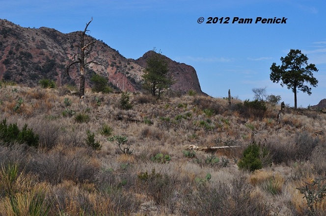
Following up on my overall impressions of Big Bend National Park, today I’ll take you on a tour of the sights. Our first morning we drove up into the Chisos Mountains to hike the Chisos Basin Loop Trail. At an elevation of 4,500 feet over the desert floor, and with twice as much rainfall as down by the Rio Grande, the Chisos Basin is a surprising microclimate, with trees like alligator juniper, drooping juniper, Arizona cypress, pines, and oaks. Grasses grow in profusion here too although, as you can see, this area is also suffering from prolonged drought.
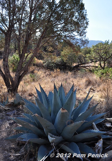
Havard agave and juniper
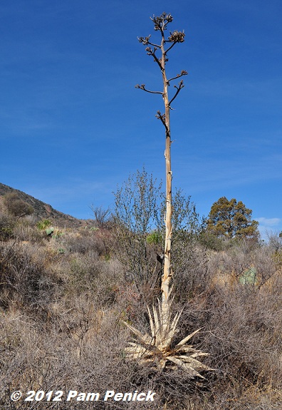
Here’s an agave that bloomed and then died. Its bleached bloom spike still stands…
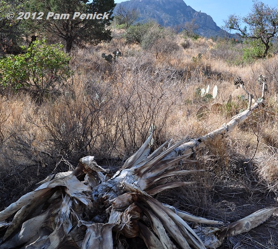
…unlike this one, which has toppled over.
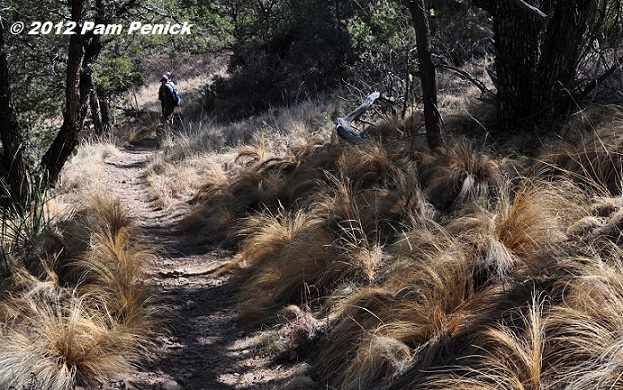
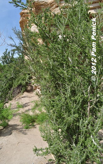
Mexican feathergrass
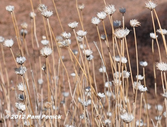
I don’t know what these pretty, white seedheads are. Anyone recognize them?
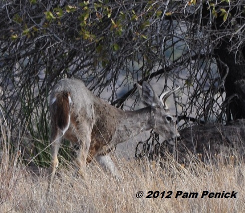
We spotted a few Carmen white-tailed deer in the Basin.
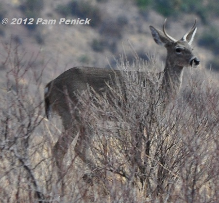
Carmen deer live only in the Chisos Mountains and in nearby mountains in Mexico, isolated here after the last Ice Age, as the surrounding country warmed and turned into a desert.
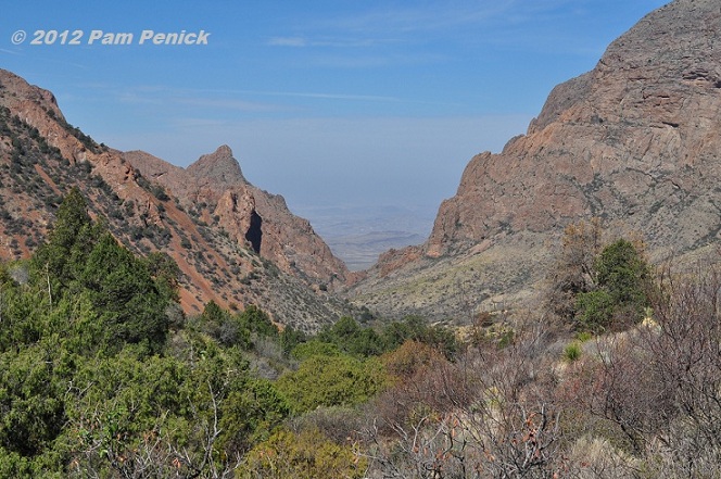
The Window View is a much-photographed spot.
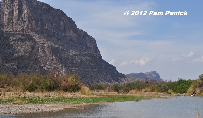
As the day heated up and the sun grew intense, we spent time driving the park roads and ended up at a boat launch along the Rio Grande.
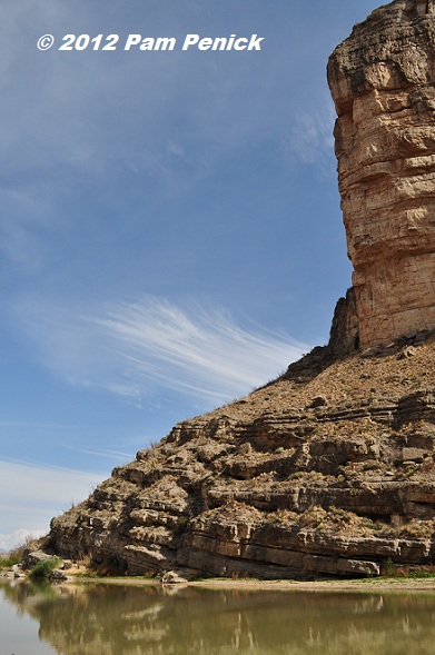
Santa Elena Canyon straddles the border with Mexico. This is the Mexican side of the canyon…
…and on the right is the U.S. side.
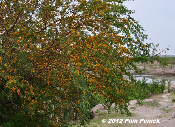
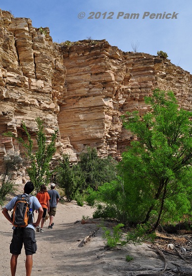
The next day we drove to Boquillas Canyon to hike, where I spotted huisache (Acacia farnesiana) in full bloom.
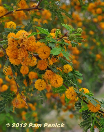
The flowers look like yellow pom-poms.
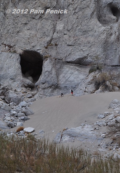
Just inside the canyon, a steep sand dune beckons the adventurous (and fit) to clamber up the deep, slippery slope, which you almost have to do on all fours. Only my husband made it to the top, along with a father and son from Belton, Texas.
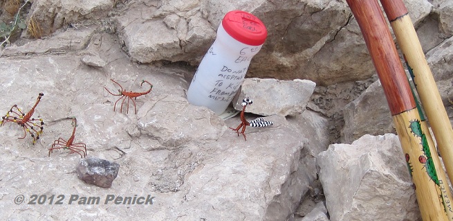
Strategically placed along the trail, little beaded scorpions and roadrunners and carved walking sticks are offered “for a donation for the kids of Boquillas,” with only a collection cup and the honor system. We understood, from prohibitive signs in the parking lot, that Mexicans from the town of Boquillas, visible just across the river, were selling these trinkets to tourists, even though they risk deportation 100 miles away by the U.S. Border Patrol if caught. The signs advised that buying would only encourage the illegal trade and possibly result in the seller’s deportation and confiscation of anything you bought. What a sad situation. Before 9/11, the border between Boquillas and the U.S. was open, and the tourist trade flourished. However, the border crossing was officially closed after 9/11, destroying the Mexican town’s livelihood. According to Wikipedia, most of the residents have had to abandon Boquillas.
The day grew warm, but we headed next to the park’s hot springs, along with more tourists than we’d seen anywhere.
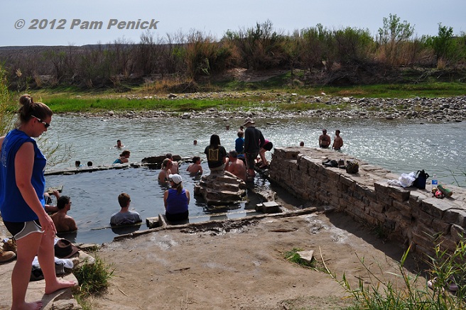
Apparently a dip in a hot pool sounds good even on a hot day. Volcanoes created Big Bend millions of years ago, and there’s still enough heat under the earth’s crust to warm the spring-fed pool.
This nondescript, upright shrub was alive with a deep humming.
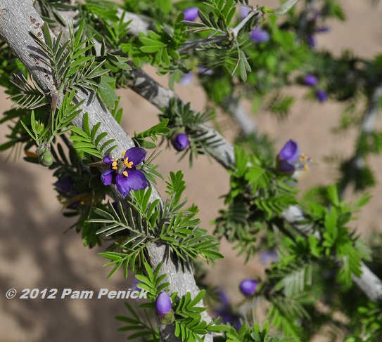
Its branches were covered in pretty, purple flowers…
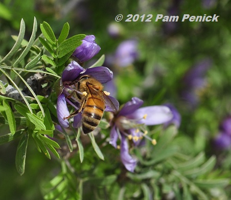
…and hundreds, maybe thousands, of busy honeybees. Does anyone know the name of this desert shrub? This is guayacan (Guaiacum angustifolium). My thanks to David R. for the ID.
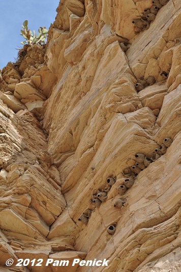
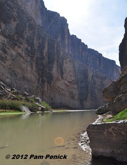
Above, the mud nests of cliff swallows adorned the stratified cliff wall along the river.
This would be a fascinating place for a geologist.
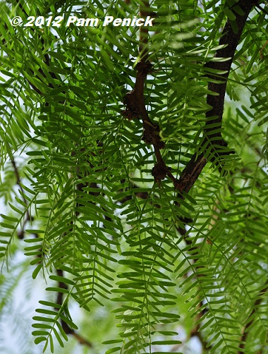
Fresh, green mesquite leaves
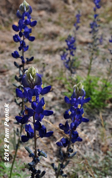
Back on the road, we spotted Big Bend bluebonnets (Lupinus havardii). They are much taller than the bluebonnets in central Texas, as befits of place of such extremes. In case you’re wondering, all varieties of Texas bluebonnets are officially Texas’ state flower.
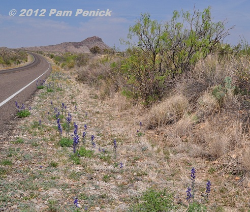
Because of the drought, the bluebonnets and other wildflowers were sadly sparse. In wetter springs I’ve heard the desert floor can be colorful.
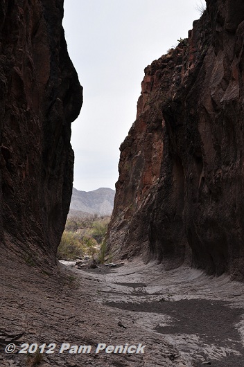
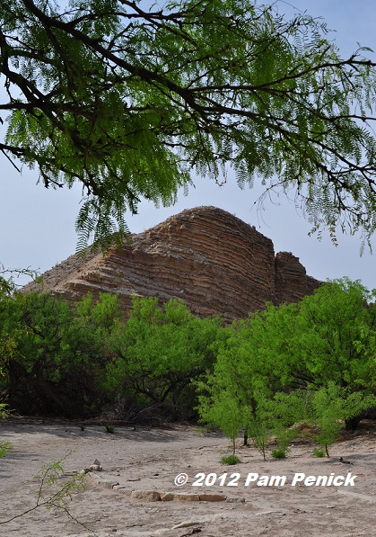
We left Big Bend on Saturday for the town of Marfa via FM 170, which leads through Big Bend Ranch State Park, the largest state park in Texas. The scenery along the narrow, twisting highway, which climbs through ancient volcanic mountains, was as good as anything we saw in the national park. We stopped to hike Closed Canyon, a narrow slot canyon carved by occasional flooding that leads to the Rio Grande. There had been a thunderstorm the night before, but by the time we arrived the water was gone and a flash flood unlikely, so we hiked in, noting that should water rush in, there would be no escape up the smooth walls of the canyon.
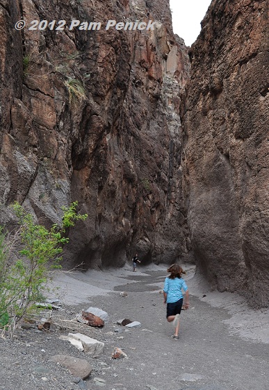
The kids particularly enjoyed this hike. The canyon floor steps down along the way, with increasingly higher drops. Unsure we could get back up, we eventually turned around and hiked back to the car, wondering how the canyon ended: was it a box canyon or open at the end? I found the answer online when I got home: it’s open all the way to the river, but steeper drops near the end may require use of a rope.
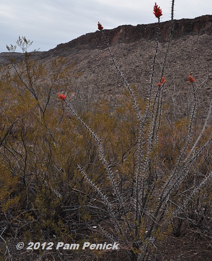
Another ocotillo in bloom
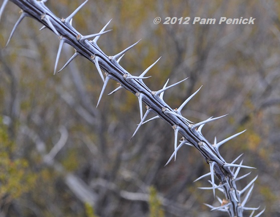
Check out those wicked thorns.
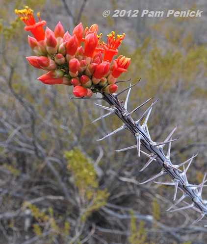
The tubular flowers are sure to attract hummingbirds.
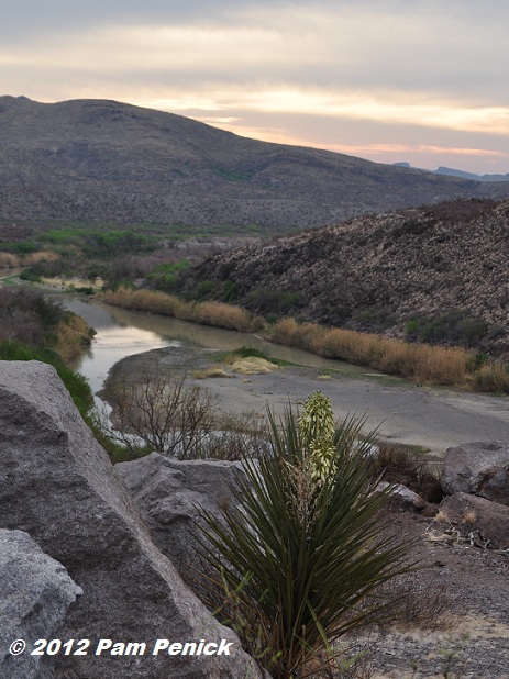
A last look back at Big Bend country.
To read my first post about Big Bend and the impact of the drought, click here. Next up: Terlingua’s ghost town and the Starlight Theatre.

By the way, my blog Digging is a finalist for Best Gardening Blog in the Readers’ Choice Awards at About.com. I’d love to have your vote. You can vote once a day (it’s on a 24-hour cycle) until March 21. So vote early and often! Thanks for your support! (And thank you to Pamela Price for the vote graphic.) Click to VOTE.
All material © 2006-2012 by Pam Penick for Digging. Unauthorized reproduction prohibited.
Looks like a lot more is blooming than 3 wks ago when I was there. We did see a few bluebonnets on the river road. I recommend a visit to the Chihuahuan Desert Research Institute south of Ft. Davis, if you can manage it. Closer to your current location, the Warnock Visitor Center has a desert plant garden. It’s in need of some TLC, but might have some cactus blooms. I’ve never seen more than 5-8 people at the Hot Springs, must be some residual from spring break. Enjoy the desert, its one of my favorite National Parks.
Thanks for your comment, Don. I hope to see more of west Texas one day, including the Ft. Davis Observatory and Balmorhea Springs. I’m glad to know about the desert plant gardens you mentioned. —Pam
What a fascinating area…and thanks to you, I got to explore it without breaking a sweat 😉 I love the white seedheads AND the purple-flowered shrub…I hope you find out what they are!
Thanks to David R., below, I learned the name of the purple-flowered shrub: Guaiacum angustifolium. It’s a beauty, isn’t it? —Pam
Thank you for the gorgeous tour! Those lupines are making me swoon.
Thanks for visiting, Heather! —Pam
The shrub is Guayacan. It grows all the way down the Rio Grande into south Texas. It’s a slow growing evergreen shrub. The late Benny Simpson planted some at Texas A&M Ag. building in Dallas years ago and may still be there. And yes, Mexican feather grass in the Basin and further up.
Thanks for the ID, David! —Pam
What a great trip. Love the orange bloom on the thorny stem. Pretty wicked. I like Mexican Feather Grass, had a lot in VA, think it is time to buy some for SC.
I use it all over my Austin garden too, Janet. It’s a wonderful grass. —Pam
Growing up in Austin, we took one family trip to Big Bend when I was a teenager. I remember not wanting to go, but it was fabulous.
Glad it was enjoyable (and plant-worthy) in spite of the drought!
Lisa
My teenager didn’t want to go either, Lisa. I hope he’ll look back on it as a fun time, though. —Pam
Looks like you had a great time. Thanks for taking us along.
We enjoy driving trips, and the desert was an interesting experience in many ways. Next time we’ll be heading north to Colorado though. We prefer mountains with trees on them! —Pam
What a great tour Pam. Didn’t you just love seeing Mexican feather grass in its true native habitat? Through your photos I really can tell how bad things are there with the drought. Such a shame. I’m so glad you got an idea on that purple bush – wow!
The feathergrass looked very nice growing on that sun-dappled slope, Jean. It gave me ideas for back home. —Pam
Such beautiful country. It is sad to see it so dry. I only thought it looked dry when I was there several years ago. It was lush compared to this.
Yes, it was very dry and brown, Lisa. I hope they get some rain soon. —Pam
Thank you so much for sharing your vacation with us. The scenery, even with the drought dead plants, was starkly beautiful, especially the sky. I have only been to a desert once in so. Colorado and really loved it, not enough to live there, but I enjoyed the vastness. I get the same feeling on the water.
I bet so, Les, so I can see why you’d have an affinity for the desert. I’d love to see southern Colorado (we’ve been to eastern CO many times, but it’s forested), especially the area around Durango. One of these days… —Pam