

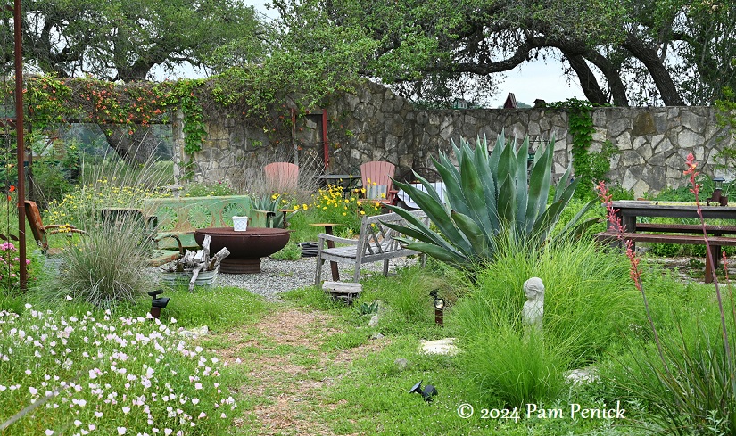
A sheep pen turned country garden in Blanco
May 06, 2024 A year ago I received an invitation to visit a unique garden in Blanco, a small town an hour west of Austin in the Texas Hill Country. Because I was working nonstop on my book, I took a rain check until this spring. Recently I drove out ...
Anemones and autumn memories in Cat’s garden
January 12, 2022 Back in late October, when Loree of Danger Garden was visiting, Cat Jones invited us over for a garden visit. Her lipstick-pink anemones, a passalong from Rock Rose‘s Jenny Stocker (who’s since departed Austin for Arizona), were blooming. We both adore these fall flowers, which Jenny kindly ...
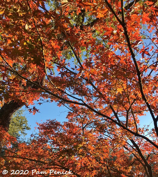
Japanese maple puts on another excellent show
December 17, 2020 The show is over now, but during the past two weeks I watched the Japanese maple at the front corner of the house blush redder and redder. Looking up through the leaves was like gazing through stained glass. I’m sure I looked odd staring up at the ...
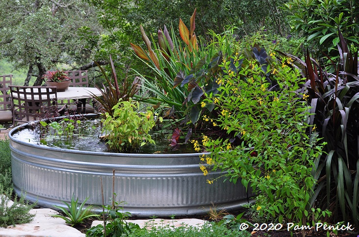
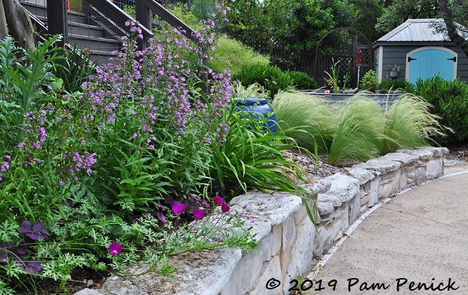
Water, water everywhere in Cat’s wildlife-friendly garden
September 22, 2020 Every time I visit my friend Cat Jones‘s garden, it’s lovelier than the time before. Over the past 4 to 5 years she’s been busily making her Steiner Ranch garden, which overlooks a wildflower meadow and a wooded canyon, into a retreat for her and her family ...
Red and yellow autumn foliage in my garden
November 30, 2019 Fall color in Austin was surprisingly good this year, including the show put on by the ornamental trees in my own garden, like the species Japanese maple (Acer palmatum). Most years it goes rusty red in mid-December, coordinating with the red Christmas balls I hang from an ...
Hilltop getaway at Two Coves Garden: Austin Open Day tour
November 21, 2019 The last garden I visited on the Open Day tour sponsored by The Garden Conservancy was designed by B. Jane Gardens, and which B. has continued to maintain for the last three owners. Located off City Park Road, the Two Coves Drive Garden perches atop a hill ...
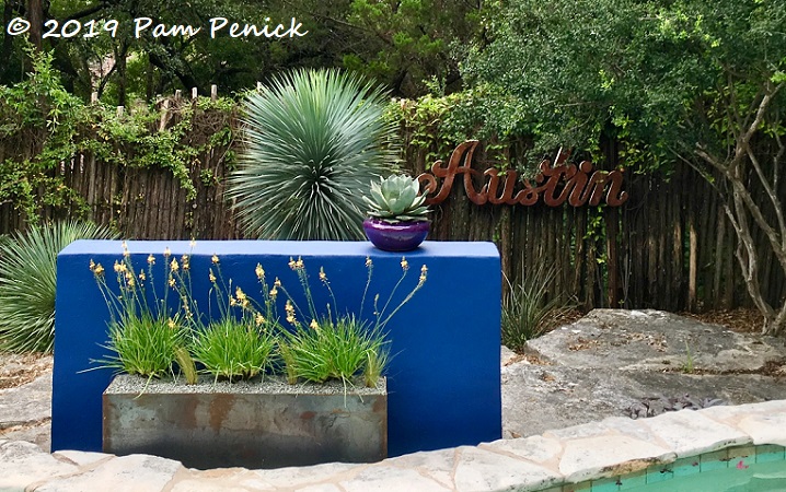
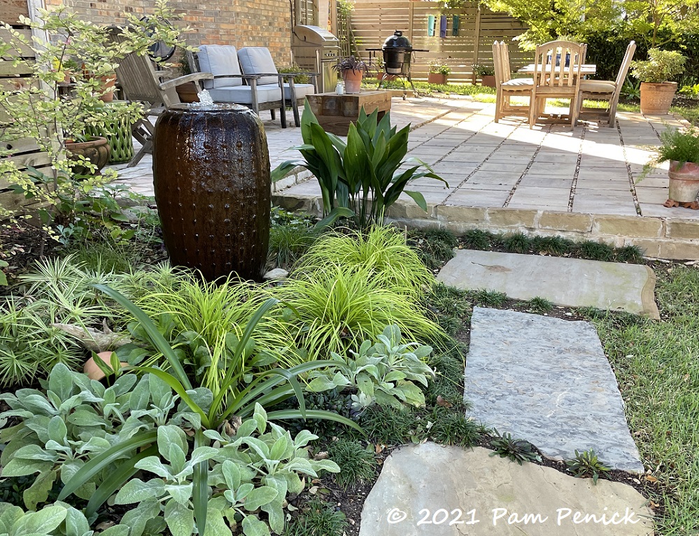
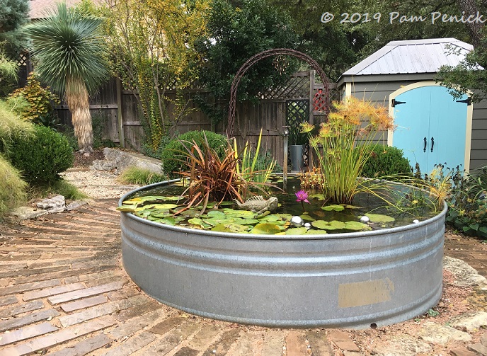
New steel planter and meadowy sedge in my garden
July 12, 2019 You might not know it from my all-day-all-night coverage of gardens on the Denver Fling tour, but I’ve been busy in my own garden too. My happiest addition is this new custom steel planter in front of the blue stucco wall by the pool. Tina Strarup of ...
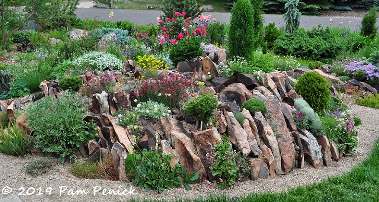
Crevice gardens to crave at the garden of Carol Shinn: Denver Garden Bloggers Fling
June 28, 2019 Colorado gardeners are crazy for crevice gardens, and no wonder. When the Rocky Mountains peek over your back fence, creating a miniature mountain range in your yard makes perfect sense. Alpine plants that thrive at high altitude and require excellent drainage love these rocky niches. Crevice gardens ...
Rocking it at Gardens on Spring Creek: Denver Garden Bloggers Fling
June 25, 2019 On a road trip to Devils Tower last August, I passed through Fort Collins, Colorado, and took the opportunity to visit The Gardens on Spring Creek. Construction was underway, doubling the size of the gardens, and so only some of the spaces were open: a flowery entry ...
Spring is abloom in shades of pink and turquoise
May 01, 2019 I haven’t done a photo tour of my own garden in a while, so let’s go, starting with a new planting of Gulf Coast penstemon (Penstemon tenuis) and winecup (Callirhoe involucrata), both Texas natives. Along with an artichoke — I’ve always wanted to try one — they’re ...
Foxgloves and cacti: A Texas-English garden, part 1
April 09, 2019 Ah, let us return to the always-stunning garden of Jenny Stocker, aka Rock Rose. Born and raised in England, Jenny and her husband, David, years ago adopted Texas as their home. Jenny’s garden, a series of stucco-walled courtyards surrounding their contemporary house, reflects her English roots but ...
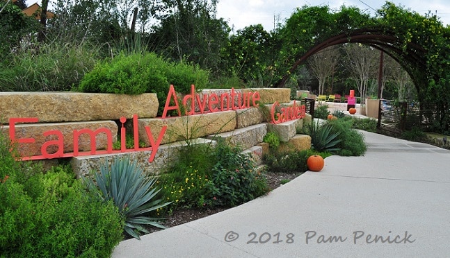
Play outdoors in magical Family Adventure Garden at San Antonio Botanical Garden
November 10, 2018 I’ve visited a lot of play gardens, and I play in ALL of them. But one of the most exciting I’ve seen opened this spring at San Antonio Botanical Garden. The Family Adventure Garden at SABG offers the delights of nature exploration that children instinctively love, and ...
Rainy day visit to Jenny Stocker’s garden
October 23, 2018 A visit to Jenny Stocker‘s gorgeous walled garden is always a treat, even on a chilly, rainy day like last Friday (and actually all this month). Jenny kindly opened her garden to me and my friend Susan Morrison, who was in town for a Garden Spark presentation, ...
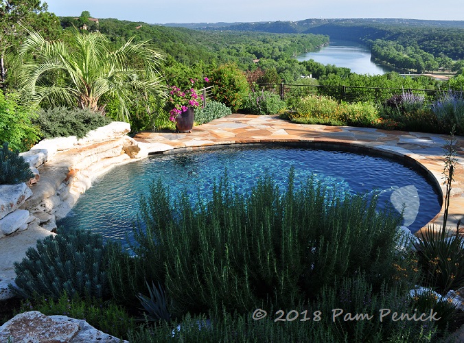
Kirk Walden’s Hill Country garden atop Lake Austin
May 25, 2018 With this killer view of Lake Austin, many homeowners might have sodded a lawn, plunked a few pots of annuals around the pool, and called it done. But Kirk Walden, whose garden was the final stop on the recent Austin Garden Bloggers Fling tour (I photographed it ...
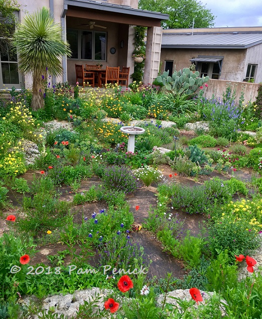
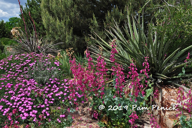
Glorious wildflowers and agaves in Jenny Stocker’s garden
April 20, 2018 Spring in Austin is glorious this year, and especially so in my friend Jenny Stocker’s garden. The Rock Rose blogger cultivates a gravel garden of mostly Texas native wildflowers and grasses sown among woody lilies like agave and yucca, accented with structural rockwork she and her husband, ...
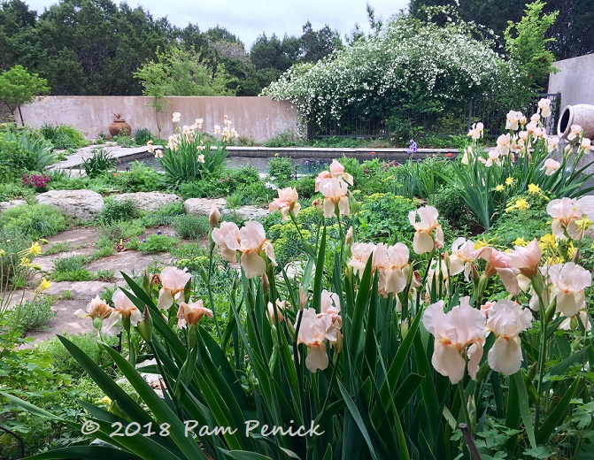
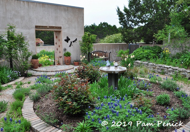
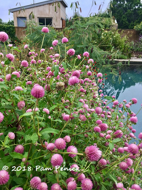
Spring flowering in Jenny Stocker’s walled courtyard gardens
March 31, 2018 When I spotted this pool-garden view from inside the home of my friend Jenny Stocker, I nearly tripped over my feet to get outside and drink it in. Jenny, who blogs at Rock Rose, is the owner of an exquisite garden that she designed herself and maintains ...