


Dry Climate Gardening book wins award!
March 13, 2024 Congrats to my friend Noelle Johnson, a horticulturist and landscape consultant in Phoenix, whose book Dry Climate Gardening has been named winner of a 2024 American Horticultural Society Award! Photo by Noelle Johnson from Dry Climate Gardening I reviewed Dry Climate Gardening last year and know what a ...
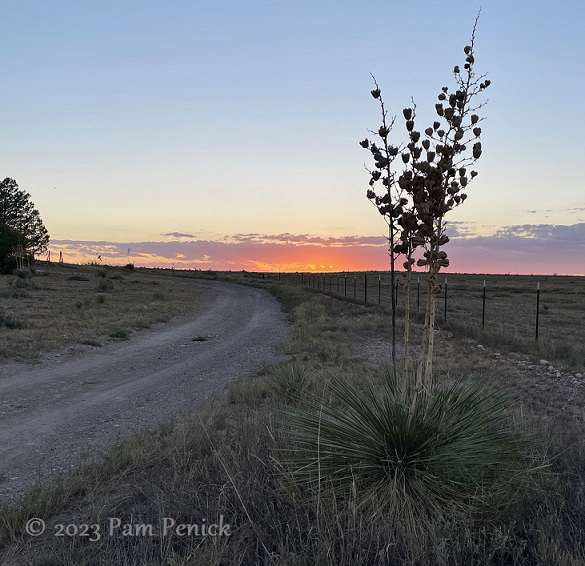
West Texas golden hour and sightseeing
September 16, 2023 I was back in West Texas a week ago to shoot gardens for my forthcoming book (due out spring 2025). Being up at sunrise and staying in gardens until after sunset meant I got to enjoy some beautiful skies every day. Lavender and mango sunsets were a ...
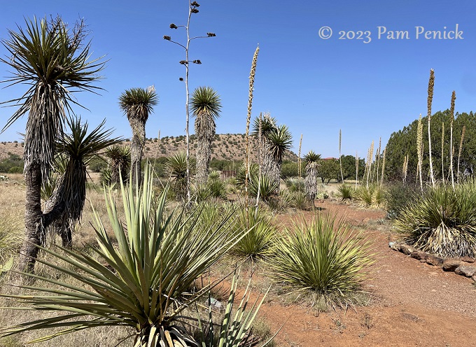
Native plants at Chihuahuan Desert Botanical Garden in West Texas
August 22, 2023 Cow’s tongue prickly pear and Mitre Peak While visiting far West Texas last month, a few people mentioned the Chihuahuan Desert Nature Center and its botanical garden, located just outside of Fort Davis. So one morning my friend and I drove over from Marfa to check it ...
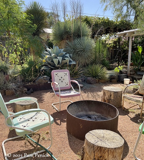
Michael Eason’s desert garden retreat
August 14, 2023 While in West Texas a couple weeks ago, I had the pleasure of visiting designer and author Michael Eason‘s garden in Alpine. Michael had lined up some wonderful gardens for me to visit there, ones that he’d designed, but it was nice to see his own personal ...
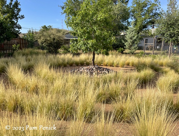
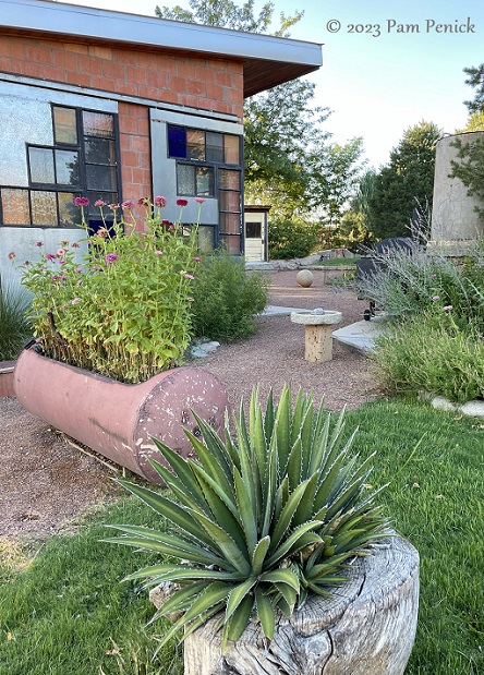
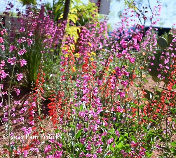
A healing garden in West Texas
August 08, 2023 A week ago I had the pleasure of visiting a lovely garden in Alpine, located in far West Texas, 400 miles west of Austin. Owner Susan Wallens showed me around and told me how the garden came to be. Susan’s husband, Mike, is the vicar of St ...
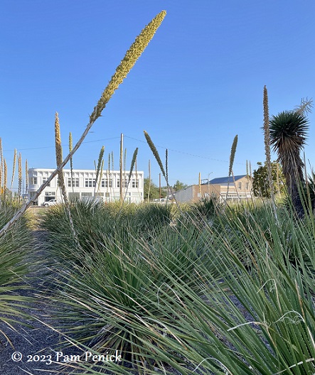
Marfa’s masses of sotols at John Chamberlain Building
August 06, 2023 I spotted a sotol convention while I was in Marfa in far West Texas last week. The spherical, toothy plants — I think these are Texas sotol (Dasylirion texanum) — are growing in a long grid in front of the Chinati Foundation’s John Chamberlain Building on the ...
Marfa love affair
August 05, 2023 Last week I made my first real visit to Marfa, the tiny (population 1,750) and improbable art mecca in far West Texas. I’d passed through Marfa once before, at the tail end of a spring break trip to drought-bleached Big Bend with small children, and I confess ...
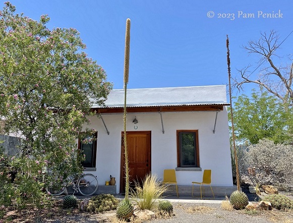
Robert Bellamy’s upcycled Marfa garden
August 02, 2023 Last week I road-tripped 7 hours west to remote Marfa, a sleepy desert town in far West Texas that’s also, thanks to Donald Judd, an art mecca drawing visitors from all over the world. Quite a few Marfa lovers from Dallas, Houston, and Austin own second homes ...
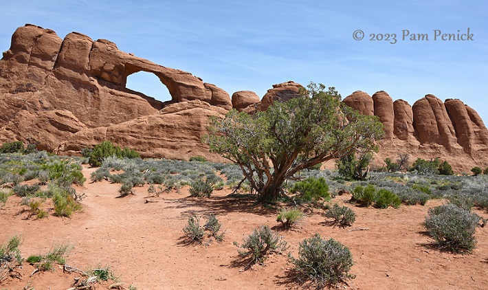
Windows to the sky at Arches National Park
July 24, 2023 North Window Arch In early May, during our national-parks RV trip, we spent a day exploring Arches National Park in eastern Utah. The place is a wonderland of hole-punched, fin-like, and soaring rock formations, including more than 2,000 documented stone arches. Located near Moab, with its hotels, ...
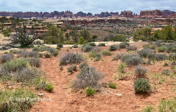
Hiking and off-roading at the Needles in Canyonlands
July 17, 2023 Canyonlands National Park spreads across 337,598 acres in southeastern Utah, divided into 3 districts by the Green and Colorado rivers: Island in the Sky, the Needles, and the Maze. In early May, after exploring popular Island in the Sky, we drove to the Needles on another day ...
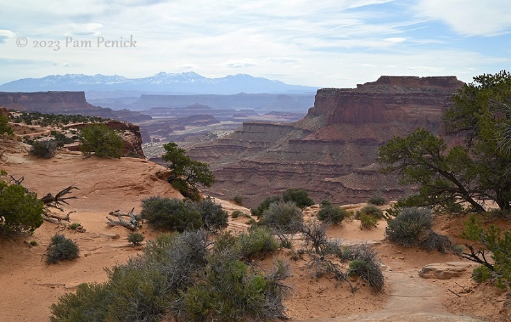
Canyonlands: Purple canyons and cliff-clinging Shafer Trail
July 12, 2023 Terracotta sand and rock stubbled with green. Terraced buttes of mauve and lavender. Blue mountains with snowy, sawtoothed peaks. A vast sky and stomach-dropping abyss. Canyonlands National Park in southeastern Utah offers awe-inspiring western vistas, beauty, and adventure and was my favorite among the Utah parks we ...
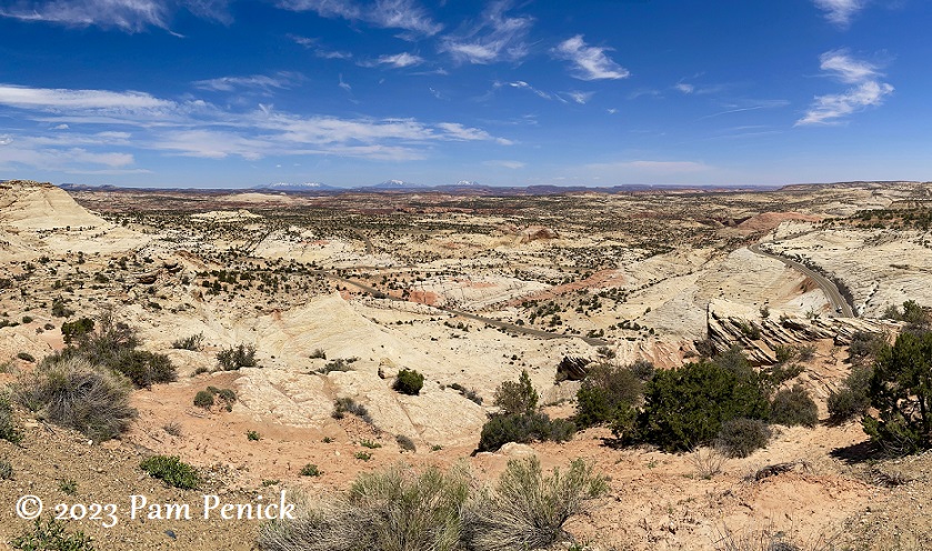
Scenery for a million miles at Grand Staircase-Escalante National Monument
July 02, 2023 Is 1.8 million acres big enough for you? That’s the size of sprawling Grand Staircase-Escalante National Monument in southern Utah, one of our stops on our spring RV trip out west. Utah felt like one big park to us — it contains 5 national parks plus 8 ...
Springtime at Red Hills Desert Garden, part 2
June 29, 2023 I squeezed in a visit to St. George, Utah’s Red Hills Desert Garden during our big RV trip, and this is part 2 of my coverage. (Click here for part 1.) In late April, the waterwise public garden dazzled with colorful desert flowers, and I wandered for ...
Desert in bloom at Red Hills Desert Garden, part 1
June 27, 2023 Utah. Red rock desert. Cactus and yuccas. When we set out in April in a rented RV to visit national parks out west, I expected hundred-mile vistas, arches, and canyons. What I didn’t expect was a flowery, beautifully designed garden of desert-appropriate plants. But thanks to a ...
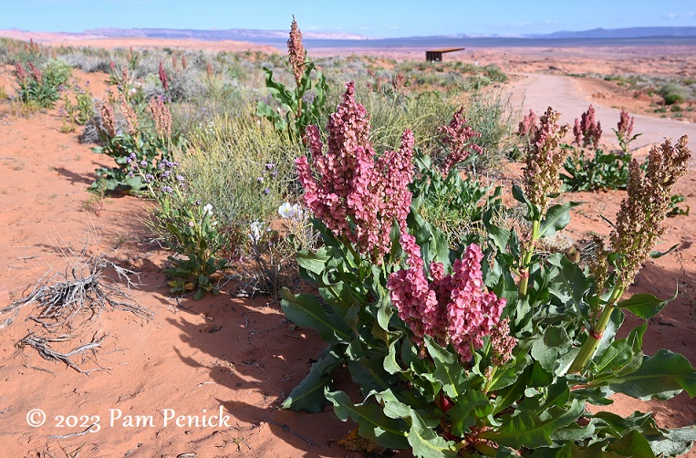
Wildflowers, breathtaking views at Horseshoe Bend and Glen Canyon Dam
June 16, 2023 Hatted and sunscreened against the intense desert sun, we took a morning walk out to see Horseshoe Bend in Page, Arizona, before our tour of Antelope Canyon. This was back in late April, during our 5-week RV trip to see western National Parks. Wild rhubarb (I think?) ...
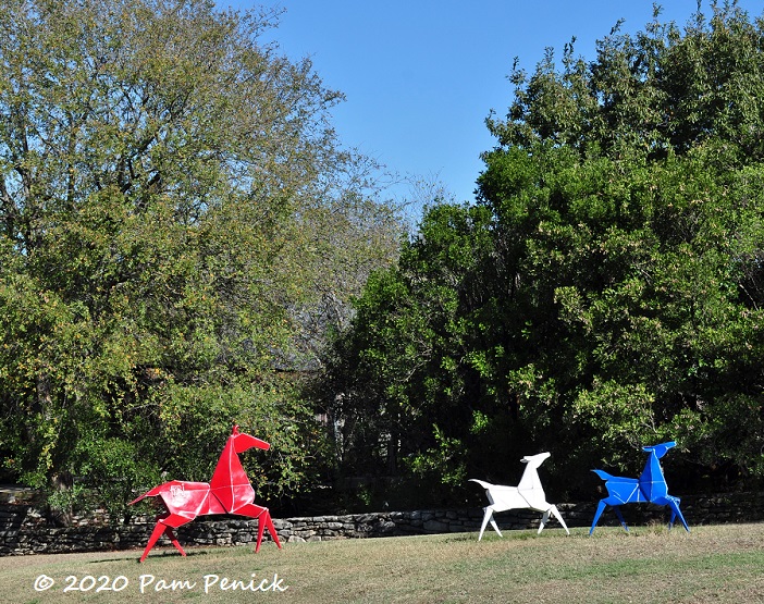
Origami sculpture and Christmasy cactus garden at San Antonio Botanical Garden
December 07, 2020 I first admired Kevin Box‘s playful origami sculptures on Canyon Road in Santa Fe. Now he’s exhibiting his work at San Antonio Botanical Garden through early May 2021. I kept wanting to visit this fall but couldn’t find time until last weekend, when my husband and I ...